TrailBird®

Ultra portable UAV for Surveillance

Designed and Made in India

The TrailBird is a vertical takeoff and landing (VTOL), fixed-wing unmanned aircraft used to provide advanced multi-sensor intelligence, surveillance, and reconnaissance (ISR) services with both day and night real-time imaging.

Tailsitter VTOL

Low-SWaP

Capable Payloads (EO/IR)

Composite Construction

Multi-sensor Intelligence

Tactical Use

Encrypted Data Link 

Modular Design

TrailBird®

40Km range

55 Minutes
Flight Time 

Telemetry
Flight Display

-20°C to 60° C
Operating Temperature

EO: HD 40x zoom
IR: 640 x 480

85 Km/h 
Maximum Speed

~4 feet Wingspan

Auto-Landing accuracy <3m

Weight <3Kg

Wind Resistance 12m/s

Min. space for take-off
and landing 2m x 2m

256-bit AES
Encryption (FIPS140-2, 
Level 2 compliant)

Imagine all the goodness with newer dimensions of vision 

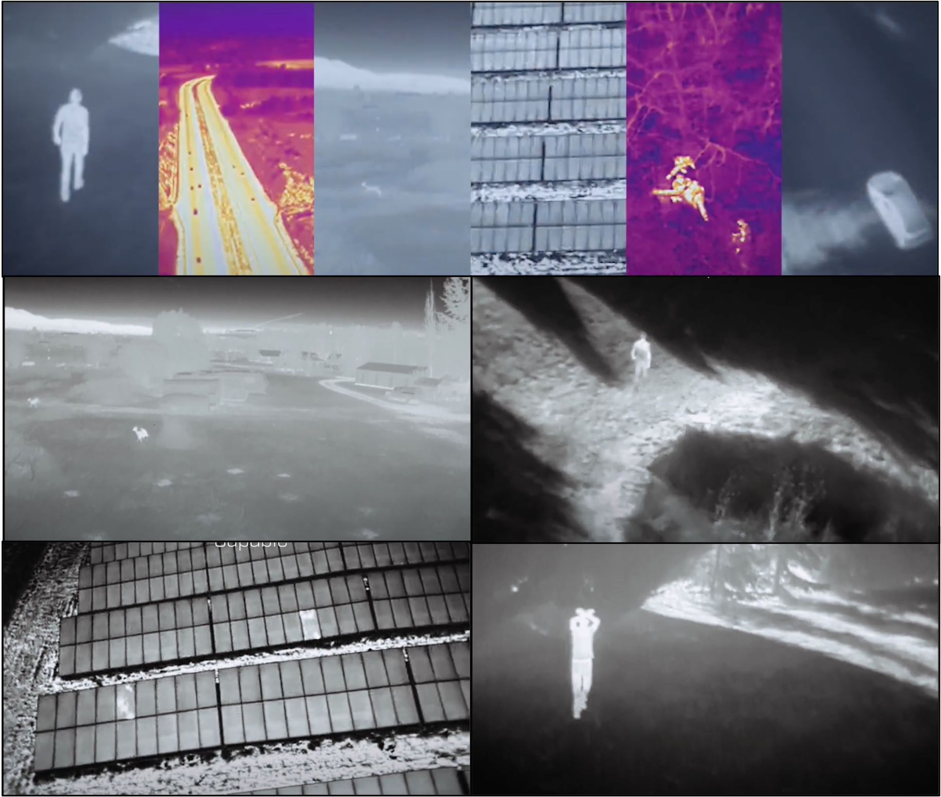
Vision Beyond Darkness with Integrated Thermal Imaging

Perfect for seeing in low light conditions and in total darkness

Vision to see hidden things that normally cannot be seen by the naked eye

Explore the great outdoors even in total darkness

Aerospace grade
composite construction


Applications

Defence and Homeland Security agencies can benefit from TrailBird to aid in intelligence preparation of the battlefield, incident response, crowd mapping, crowd management, first response and target tracking. The EO/IR video capabilities on board with excellent low light performance provide a seamless experience to track targets.

Traditional Challenges

Without comprehensive mission data, ground teams struggle with blind-spots and are exposed to unnecessary risks. Deficient situational intelligence hinders the efficient allocation of resources to maximize safety and minimize response time.

How TrailBird elevates Mission Situational Awareness

Deploy to rapidly arrive on scene and gain immediate aerial insights. Get a bird’s eye view literally! Hover above unfolding missions and eliminate blind spots. Synchronize teams, eliminate uncertainty, and allow decisions to be made with confidence.

Deployed at land or sea, TrailBird can efficiently scan vast areas and help pinpoint areas of interest thanks to its exceptionally capable EO/IR payload. Fly over areas of interest, document evidence and artefacts.

Traditional Challenges

Travel by land is very tedious and less cost effective. Mountains, forests and terrain hinder land inspections.

How TrailBird can aid Inspection and Surveillance

TrailBird can be very effective in quickly scanning an area providing an aerial view of the area in interest. It can fly over mountains and forests; terrain is not a roadblock. Automated inspections can be carried out much frequently with a fraction of the cost as compared to land inspections.

Deployed at land or sea, TrailBird can efficiently scan vast areas and help pinpoint individuals in distress, mark areas of damage and identify potential ways for first responders to reach and provide help. An aerial view in disaster management provides a third dimension of vision and has the potential to save lives.

Traditional Challenges

In the aftermath of disaster, when every moment matters, complicated terrain and environments can delay response times. Disaster areas pose hazards to victims and rescue teams which can be aggravated by a lack of clear information and communication. Relief efforts and target prioritization can be hindered by an incomplete perspective on the affected region.

How TrailBird can aid Search and Rescue

Fly over obstacles and hazards, immediately gain the power of perspective, and begin deploying care. An aerial angle can help guide ground teams, facilitate communications, and synchronize rescue efforts. Rapid modelling of affected areas can produce actionable insights to guide relief efforts.

Firefighters can adopt our next-generation UAV TrailBird, with powerful visual and thermal imaging capabilities, enabling rapid and informed decisions when responding to volatile emergency situations. TrailBird can be deployed for quick visual inspections of the affected areas and get a holistic view of the situation at hand.

Traditional Challenges

Smoke, heat, and obstacles can make it challenging to determine the scope of a fire and its threat. Limited ground perspectives of the fire can hinder the optimal deployment of attention and resources. In the aftermath of a fire disaster, it can be hazardous and costly to survey and document damage.

How TrailBird can aid Search and Rescue

Provide immediate aerial intelligence and guide optimal response to protect people and property. Scan vast areas and quickly identify fire areas, assess their threat, and optimize response. Rapidly and remotely identify threats while keeping response teams safe.

About Us

We are a startup incubated by IIT Indore. At Freebird Aerospace, our purpose is to manufacture state-of-the-art Unmanned Aircraft Systems that provide actionable intelligence from aerial data. We manufacture our products at our facilities with aerospace-grade materials using machining centres and advanced composites.

Our solutions give our customers a fresh vantage point, positioning them to see the world with new eyes and extending their reach beyond the line of sight. That is the power of our breakthrough unmanned aircraft systems.

Whether they are warfighters searching for an enemy, border patrol agents searching for people in need of assistance, or businesses securing their perimeter, our systems generate actionable intelligence reliably, creating a path to goals that would otherwise be unattainable.